|
Luxor Map
Introduction to Luxor and
its significance
Luxor, located in southern Egypt, is
a city of great historical and cultural
significance. It was once the ancient capital of
Egypt and is home to numerous archaeological sites
and monuments that attract tourists from all over
the world. The city was known as Thebes in ancient
times and played a significant role in the
development of Egyptian civilization . Luxor is
celebrated by archaeologists for providing a glimpse
into the daily lives of ancient Egyptians through
the various artifacts and structures that have been
unearthed . The city's deep religious nature is
reflected in the many temples and tombs that have
been preserved to this day .
Luxor is a popular tourist destination and is often
referred to as an open-air museum due to the
abundance of historical sites and monuments that can
be found in the city. The city's tourist map is an
essential tool for visitors who want to explore the
various attractions that Luxor has to offer. The map
includes all the tourist sites, museums, and
important religious sites, making it easy for
visitors to plan their itinerary . The map also
highlights the best restaurants and major
transportation hubs in the city, making it an
indispensable resource for travelers .
The importance of the map of Luxor cannot be
overstated for tourists who wish to make the most of
their visit to this historical city. The map
provides a detailed and high-resolution view of the
city, allowing visitors to plan their visit with
precision . The map is available for free
download and can also be customized to suit
individual needs. Whether it's exploring the Valley
of the Kings and the Valley of the Queens or
visiting the many temples and tombs, the map of
Luxor is an essential tool for anyone who wants to
experience the city's rich history and culture .
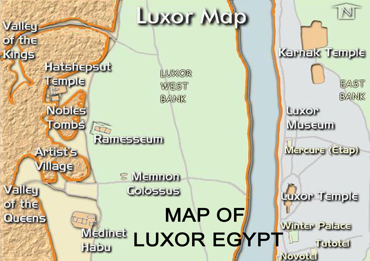
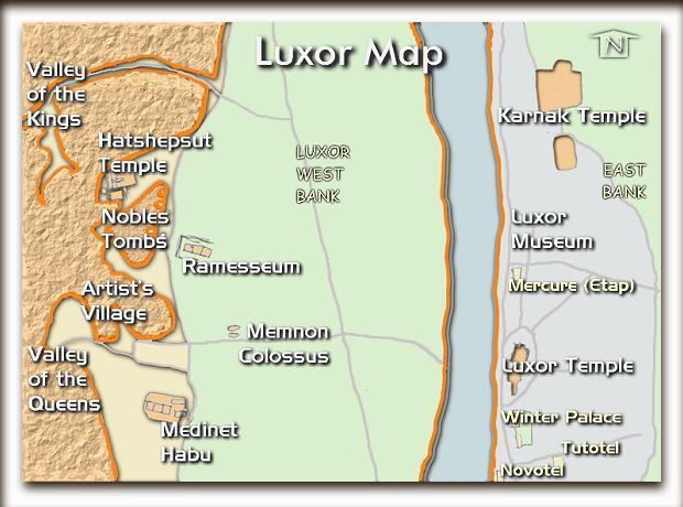
Major attractions in Luxor
One of the major attractions in
Luxor is the Valley of the Kings, which is situated
on the west bank of the Nile River. This
archaeological site contains the tombs of many
pharaohs from the New Kingdom period, including
Tutankhamun and Ramses II . Visitors can explore
the various tombs and marvel at the intricate
hieroglyphics and artwork that adorn the walls. The
Valley of the Kings is a must-see destination for
anyone interested in ancient Egyptian history and
culture .
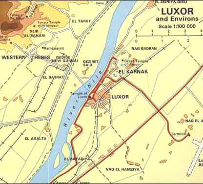
Luxor Map
Map of Luxor
Luxor on map
Egypt Luxor map
Another popular attraction in Luxor is the Karnak
Temple Complex, which is located on the east bank of
the Nile River. This vast complex comprises numerous
temples, pylons, chapels, and other buildings that
were constructed over a period of 1,500 years .
The complex is dedicated to the worship of the god
Amun, and it is one of the largest religious sites
in the world . Visitors can explore the various
structures and marvel at the impressive architecture
and artwork on display. The Karnak Temple Complex is
a testament to the ingenuity and creativity of the
ancient Egyptians .
Luxor on map
The Luxor Temple is another fascinating attraction in
the city, located on the east bank of the Nile
River. This temple complex was built during the New
Kingdom period and was dedicated to the god Amun
. Visitors can explore the various structures
and marvel at the impressive artwork and
hieroglyphics on display. The Luxor Temple is a
testament to the skill and creativity of the ancient
Egyptians and is a must-see destination for anyone
interested in ancient history and culture .
Key features of the Map of
Luxor
The Map of Luxor, Egypt provides
detailed information on the streets, landmarks, and
attractions in the city. The map is easily
accessible through various online platforms and
offers a satellite view of Luxor, including the
nearby Valley of the Kings and the Valley of the
Queens . The map also includes street names and
building locations, making it easy for tourists to
navigate the city . Additionally, the map
features labels, a ruler, and a search function to
help visitors find their way around Luxor . With
over 6,622 km of streets and paths, the map provides
a comprehensive guide to the city's layout and
attractions, including over 97 sights and monuments.
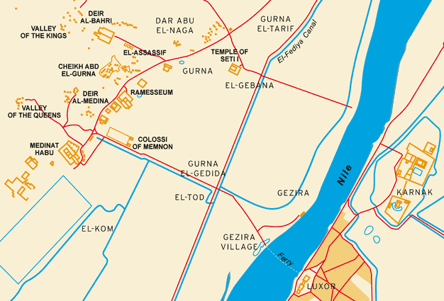
Egypt Luxor map
Public transportation is an essential aspect of any
city, and the Map of Luxor provides information on
the various transportation routes available in the
city. Moovit, a popular transportation app, offers
free maps and live directions to help visitors
navigate through the city, including schedules,
routes, and timetables . Additionally, the map
provides information on the bus route map, north and
southbound buses in Las Vegas, and other
transportation options . The map also
includes information on major transportation hubs in
the city, making it easy for tourists to plan their
travel .
Map of Luxor
The Map of Luxor also provides recommended tourist
itineraries, making it easy for visitors to plan
their trip. The itineraries include top attractions,
restaurants, and major transportation hubs, all in
one interactive map. Visitors can use the
interactive map to keep track of their places to
visit, flight and hotel reservations, and day-by-day
itineraries for their trip to Luxor . The
map provides a guide to the perfect 2-day itinerary
in Luxor, as well as itineraries for 3 or 4 days,
allowing visitors to experience the best Luxor has
to offer .
|